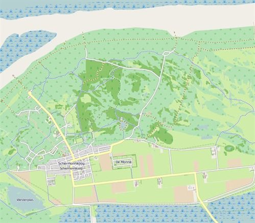
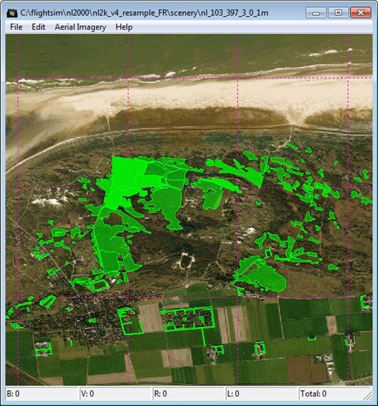
As I mentioned in my previous blog posts I am trying to create autogen from GIS vector data. For my first test case I am using the OpenStreetMap data of the Dutch island of Schiermonnikoog. Below you see a screenshot from the data, as well as a screenshot in the Annotator tool showing the autogen I have made.
It isn’t perfect yet, but I am quite happy already with the first results from tonight. Some of the forests are still missing, so there are still a few bugs left in my tool. But on the other hand quite a big part is already there.
Next step after the forests will be to try the footprint data of buildings that is also in OpenStreetMap, since that was my prime goal anyway. So see if I could fill whole areas with autogen buildings. I’ll keep you posted about the progress.
 SceneryDesign.org

This is looking EXTREMELY promising Arno!! Crack this, publicise it enough, and then droves of people will start making autogen from Shapefiles all over the world… The mind boggles!! 🙂
superb, which beautiful work you make for the community fsx like French “Benny” who did that for Xplane and which also starts for FSX.
On the other hand I tested your AGN2txt and I have a planting before the end of the listing, but it is not serious, essential it is that you arrive there, congratulations!
Have you made a beta release than I can test? Thanks!!!
Hi, I posted a link yesterday after your other comment. You can get the test version at http://www.scenerydesign.org